When you live in the city, it is easy to feel as though you are out of touch with nature. The plants around us appear to sparse and blend into the background of the metropolis landscape, a complete transformation from what it would have looked like pre-contact. Native Plants of the High Line is a project brings the natural ecology of an urban landscape to the forefront with a StoryMap exploring native plants and related traditional ecological knowledge.
What is Native Plants of the High Line?
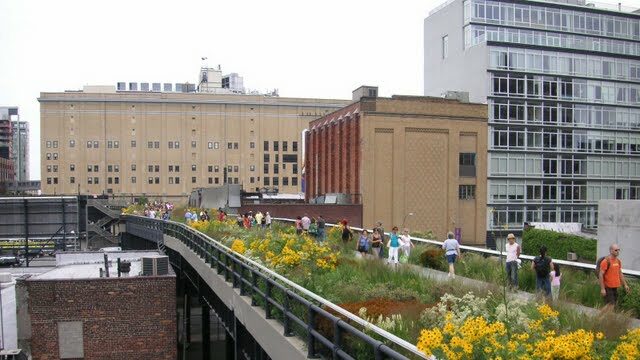
This project is an interdisciplinary exploration of the ethnobotanical knowledge along the High Line, historic, elevated rail line turned public park in the unceded territory of the Lenape people on the west side of so-called Manhattan, New York City. It was created by a group of non-native settler scholars in 2020 and is guided by the following research question:
How do the plants that are used in local parks compare to what would have grown here natively?
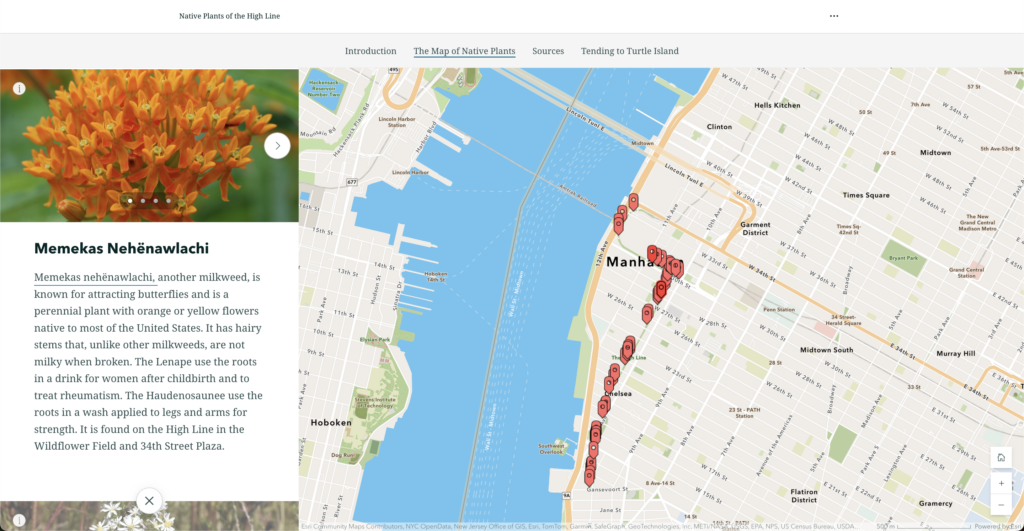
Researchers began to explore this question using ecological and ethnobotanical data from the Welikia Project and the Native American Ethnobotany database as well as mapping software from ArcGIS Storymaps. As part of their efforts to center Indigenous knowledge, the project attempts to move away from Linnean botany by utilizing the Lenape names for the plants as much as possible. The Lenape Talking Dictionary is also embedded into the StoryMap so people can learn the proper pronunciation of the Lenape plant names.
Native Plants of the High Line is also part of a larger project, Tending to Turtle Island: Indigenous Peoples, Settler Colonialism, and Plants in North America, created by the fall 2020 class “Advanced Projects in Digital Humanities” at the Pratt Institute’s School of Information.
Why We Think it is DEH
Tending to Turtle Island was purposefully created within the framework of DEH and serves as a series of case studies on how Indigenous peoples and knowledge could be better centred in the field of DEH2. DEH is centred on the practice of critically analyzing how space and lifeworlds are conceptualized using digital technologies. Mapping plants using Indigenous ways of knowing is therefore an obvious research topic in the field of DEH as it attempts to understand counter-narratives for how this urban landscape has been conceptualized in the face of dominant power structures3. Explore the project for yourself by checking out the Native Plants of the High Line StoryMap or by visiting the Tending Turtle Island webpage.
Want to learn more about ArcGIS StoryMaps as a DEH tool? Check out our DEH tools page.
- Read more about the creators’ approach in their chapter, “Countermapping Plants and Indigenous Lifeways in North America: A Case Study of Tending to Turtle Island” (Dennis et al. 2022) in Routledge Handbook of the Digital Environmental Humanities ↩︎
- This method of mapping is also referred as counter-mapping. You can learn more about this method in the aforementioned chapter or in this short essay on the power and politics of mapping (Kitchin et al. 2011) in The Map Reader: Theories of Mapping Practice and Cartographic Representation ↩︎